Split Polylines
#updated
Purpose
Input features: 
Output features: 
The tool is aimed to advanced splitting of polyline features.
Description
The tool provides ArcGIS Pro users with capabilities to split polyline features into separate segments in various customizable ways. As a result, the tool creates a new linear feature class preserving attribute information from the input feature class. A new feature class is a set of lines, which is the result of splitting the original lines in a way chosen by the user.
Split methods
Following split methods are available:
-
At all vertices
Input polylines will be split at all vertices, the number of output polylines depends on how many vertices exist in the input polylines. Note, in some cases the vertices density can be high enough so that applying this method will result in great many of short polylines. In such cases you can apply the Show Nodes tool first, to figure out how many nodes (vertices) are there in the input polylines.

-
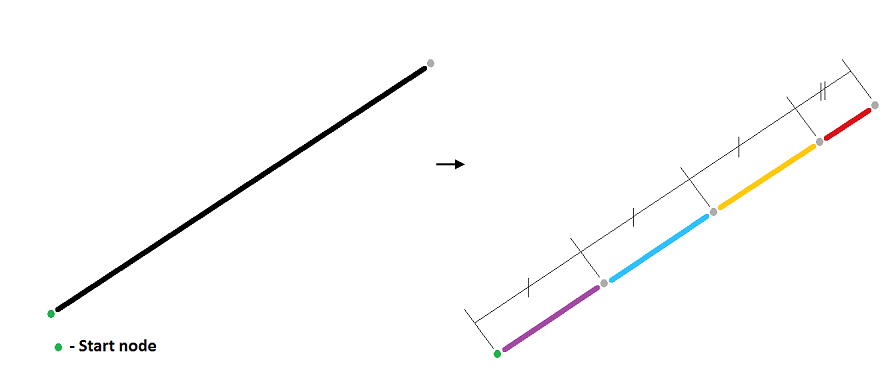
Into specified segments
Input polylines will be split into segments of the specified length (except the last segment), at that splitting always starts from the start node of the input polylines.
-
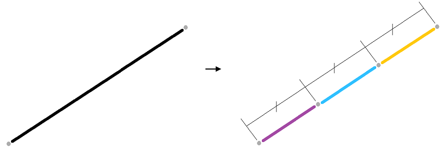
Into equal segments
Input polylines will be split into given number of equal segments.
-
At intersections
Input polylines will be split at all intersections within the input polyline layer. This option can be useful when dealing with non-topological or spaghetti digitized line work.

-
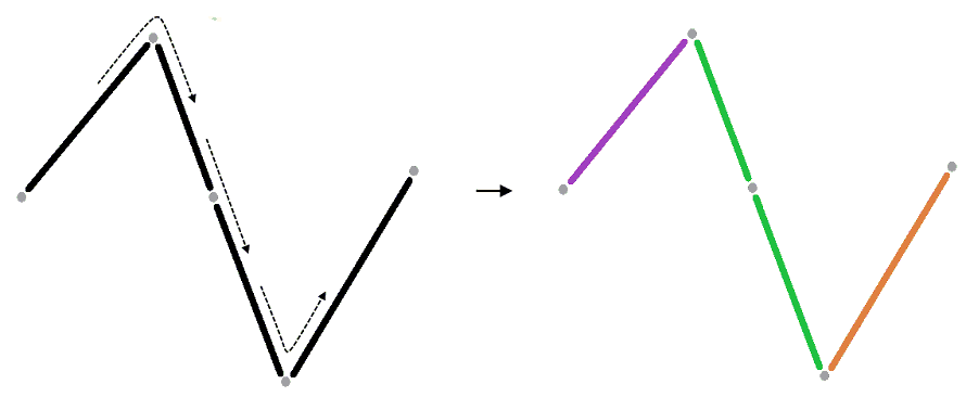
At the points of change of any direction
This method allows the user to split the input polylines at the points of their direction change. If the polyline contains arc segments, then such areas will be considered as linear segments.
-
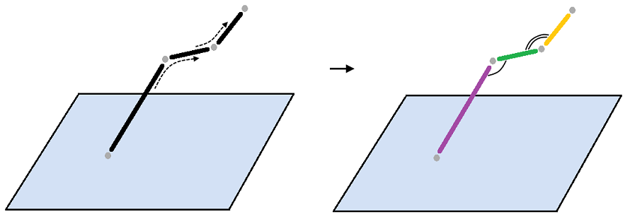
At the points of change of slope
Input polylines will be split at the points of the slope direction change (this option relates and can be applied to 3D polylines).
-
By another layer
Input polylines will be split at the intersections with another specified polygon, polyline or point layer (or by selected features of another layer).
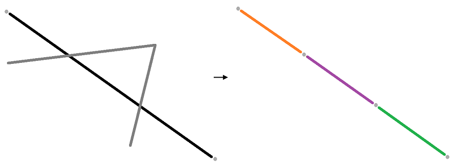
Special case - Polyline with separate parts
Such polylines split without considering the distance between the segments.
Splitting polyline into 4 equal segments:

Options
The following additional options are also available in the tool:
-
Use selected objects
Allows to split only selected input objects
-
Add the input ID field
Allows the user to add an ID field containing the identifiers of the input objects to the attribute table of the output layer. The default ID field name can be changed.
Usage
-
Select the "Split Polylines" tool from the Geometry tools of XTools Pro gallery.
-
Select the input layer containing polylines that you wish to split using Map content, Catalog, History or Favorites.
-
Specify the name and location of the output feature class using Catalog, Document locations, Home GDB, History or Favorites. The output data can be saved in a shapefile or in a geodatabase.
-
Select method for splitting input polyline features.
-
Press Run to split polylines.
Notes
-
When polylines are split at intersections with other layers they are split at self-intersections as well.
-
When splitting by point layer it is highly recommended to specify and use tolerance, otherwise make sure that points are located exactly on the polylines.


