Rotate Point Symbols
Purpose
|
Input features: |
|

The tool is provided for rotating symbols of point features on the map along specified polylines or polygons. As a result, new angle values are added to the attribute table and point symbols are rotated on the map according to the angle values.
Description
The Rotate Point Symbols tool allows to promptly rotate symbols of point features along the polylines or polygons, considering specified parameters.
Rotation angle values are added to the new or existing attribute field of the input points feature class. These angle values are applied to the point symbols in the properties of the selected layer.
The tool can be launched from the Feature Tools menu (New menu) or from the Feature Conversions menu (Classic menu). It is also available as a geoprocessing tool from the XTools Pro toolbox in ArcToolbox.
Usage
In order to rotate point symbols, the following parameters are required:
-
Input features. Input features are point features. If there are any selected points in the input features, then symbols of only those selected features will be rotated.
-
Baseline features. These are polylines or polygons along which point symbols will be rotated. If there are any selected features, then point symbols will be rotated only along those features.
-
Buffer size. Buffers allow rotating symbols only for those points that are within the specified buffer area around the baseline features.
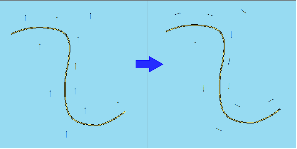
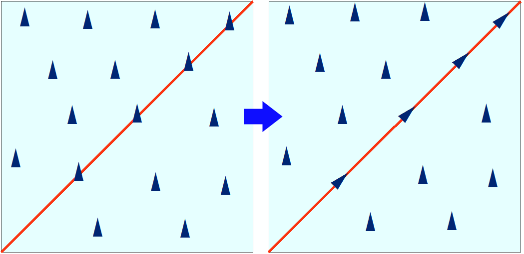
If buffer size is not specified, all point symbols will be rotated along the nearest polyline (or polygon) segment:
If buffer size is set as 0 then symbols will be rotated only for those points lying exactly on the polylines (on polygon segment):
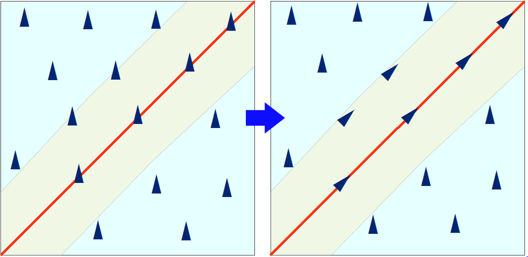
If a non-0 buffer is specified, then symbols will be rotated only for those points within the buffer area:
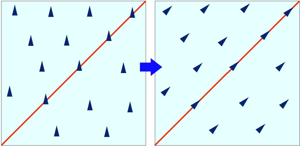
Rotation angles are calculated as follows:
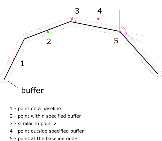
Points 1, 2, 3, and 5 are within the buffer area. For the points 1, 2, 3 symbol rotation angle is taken from the nearest baseline feature segment, for the point 5 rotation angle is calculated as mean value between adjacent feature segments. Point 4 is not within the buffer area so its symbol won’t be rotated.
-
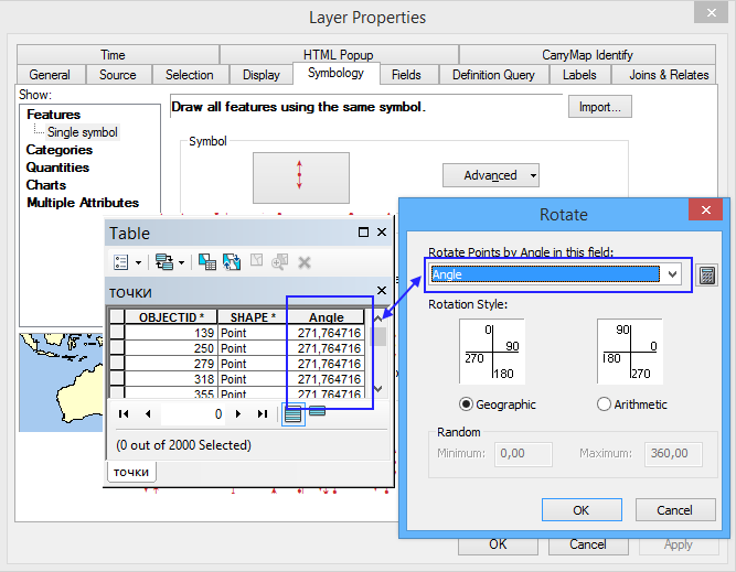
Angle field name. Any allowed name can be specified for the new field with angles. If an existing field is selected, then values will be updated only for the processed points. Older values for unprocessed points (e.g. those outside the buffer area) will remain unchanged.
-
Options. In the Options it is possible to specify the rotation style and rotation angle correction.
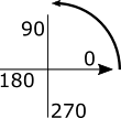
There are two rotation styles supported:
- Geographic, where symbols are rotated from North in a clockwise direction.
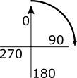
- Arithmetic, where symbols are rotated from East in a counter-clockwise direction.
Angle correction allows to specify angle value that will be added to the calculated rotation angle.
Note
It is recommended that the input points and baseline features are in the same coordinate system. Point symbols may remain unrotated or be rotated incorrectly because of different coordinate systems of input points and baseline features.
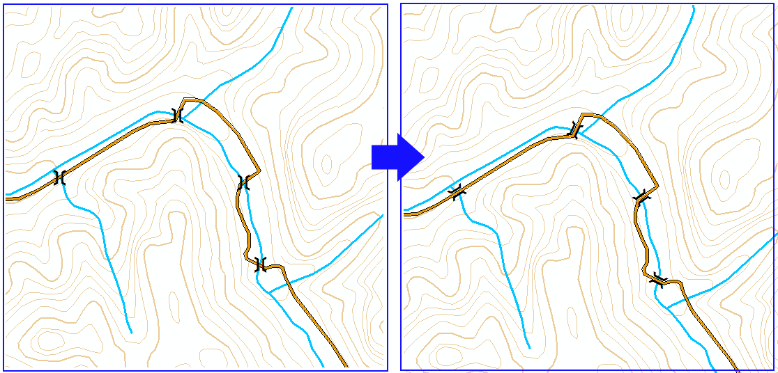
Example
You can use the Rotate Point Symbols tool when designing a topographic map to rotate bridge symbols along the roads.