


Align Polygons
Purpose
|
Input feature types: |
|
|
Output feature types: |
|


The tool is provided for aligning polygons along specified baseline features.
Description
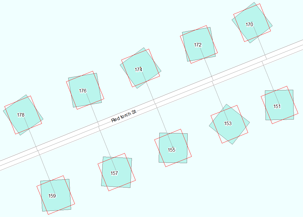
The tool allows aligning polygon features along specified baseline features. At that, it is possible to define maximum distance to baselines within which polygons will be aligned. Output polygons are stored in a new feature class (pic. 1, 2).
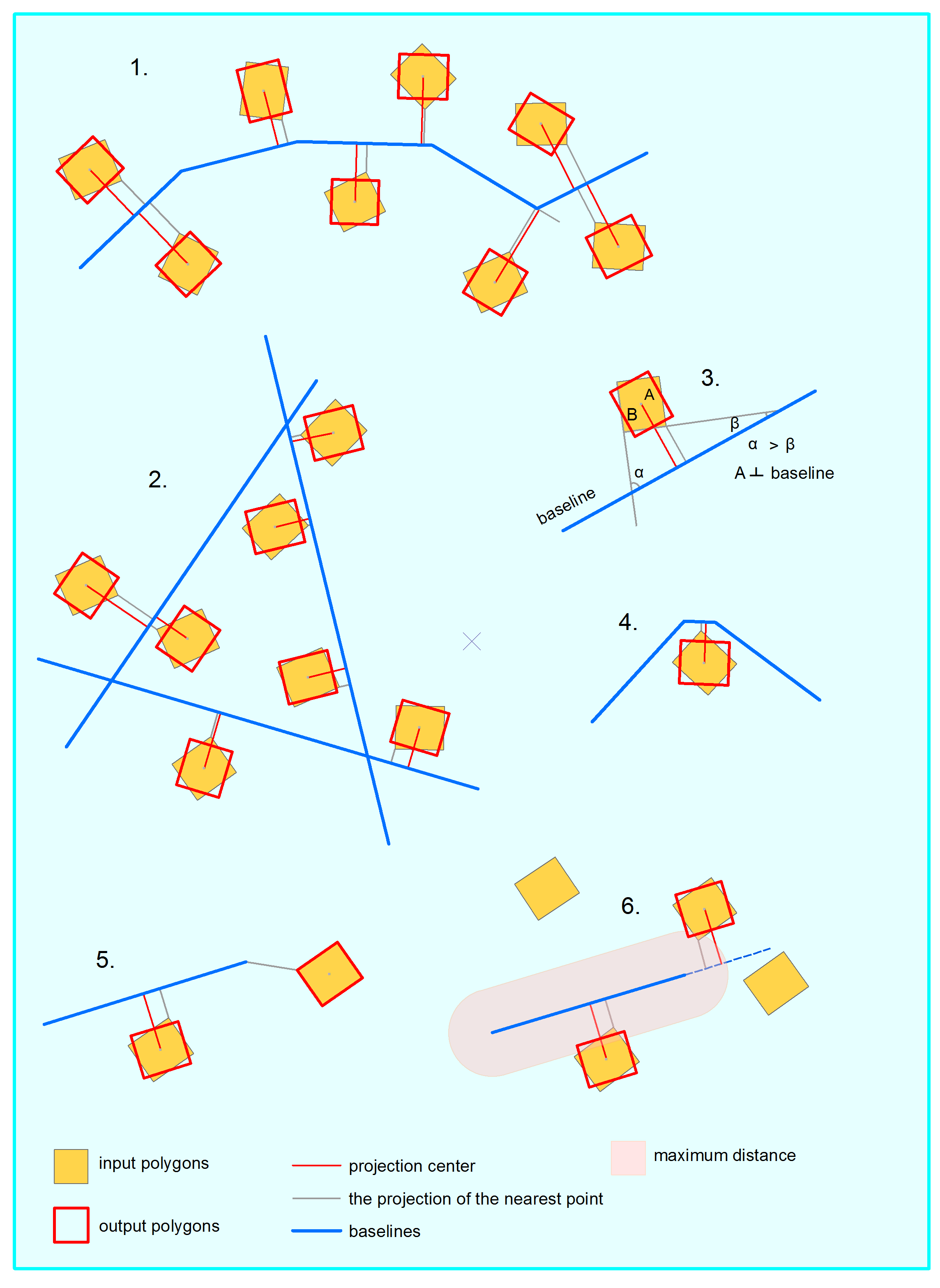
For each input polygon the tool defines the closest segment of the specified baseline features.
When aligned the polygons are rotated so that the polygon side having the least angle with the baseline feature becomes parallel to the baseline feature (pic. 3). At that, polygon side length does not matter.
Nearest to a polygon segment of the baseline is taken into account (pic. 4).
If maximum distance is specified, then all polygons located partly or wholly within the specified distance from their baseline features are rotated.
If maximum distance is not specified and a polygon nearest point cannot be projected to the baseline (pic. 5), then it is copied to the output feature class as is without rotation.
If a polygon is within the maximum distance from the baseline and its nearest point cannot be projected to the baseline, then it is rotated along the extended baseline segment (pic. 6). If it’s not within the maximum distance, then it is copied to the output feature class as is without rotation.
Curves in polygons are densified and then aligned accordingly.
Attributes of the input polygons are transferred to the output feature class. As an option, it is possible to add a field with input feature IDs.
Exceptions
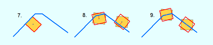
1. If a polygon side coincides with the baseline feature (pic. 7), then it is copied to the output feature class as is without rotation.
2. If a baseline feature intersects a polygon (pic. 8), then its closest segment is counted from the polygon centroid. Such polygon is rotated along this baseline segment then.
3. If a polygon centroid is located on the baseline feature, then the polygon is rotated along this baseline (pic. 9).
Usage
To align polygons along baselines, it is required to specify the following parameters.
-
Input features. Input features are polygons. If there are any selected features in the input layer, then there is an option to process only selected features.
-
Output feature class. This parameter specifies output dataset with aligned polygons. Output can be saved in the shapefile format or as a geodatabase feature class.
All attributes of the input polygons will be transferred to the output feature class.
-
Baseline features.This parameter specifies polylines along which input polygons will be aligned. Processing of only selected polylines is supported.
-
Output spatial reference. For output data, it is possible to specify spatial reference using one of the following options: input data, data frame, map layer or spatial reference from the list.
-
Maximum distance. This is a distance between input polygons and baseline features. If maximum distance is specified, then only the polygons within this distance will be aligned.
If maximum distance is not specified, then all input polygons will be aligned along the nearest baseline features.
For the maximum distance equal to 0 only those polygons intersecting or touching baseline features will be aligned.
-
ID field. This allows adding a new field with input polygon IDs to the output feature class. Default ID field name can be changed.