Graphics to Shapes
Purpose
This tool creates a feature class for each user-selected shape type (graphics) in the ArcMap Data View.
Description
Rectangle, circle and polygon graphics are converted to polygon shapes. Polyline graphics are converted to polyline shapes. Point graphics are converted to point shapes.
Usage
-
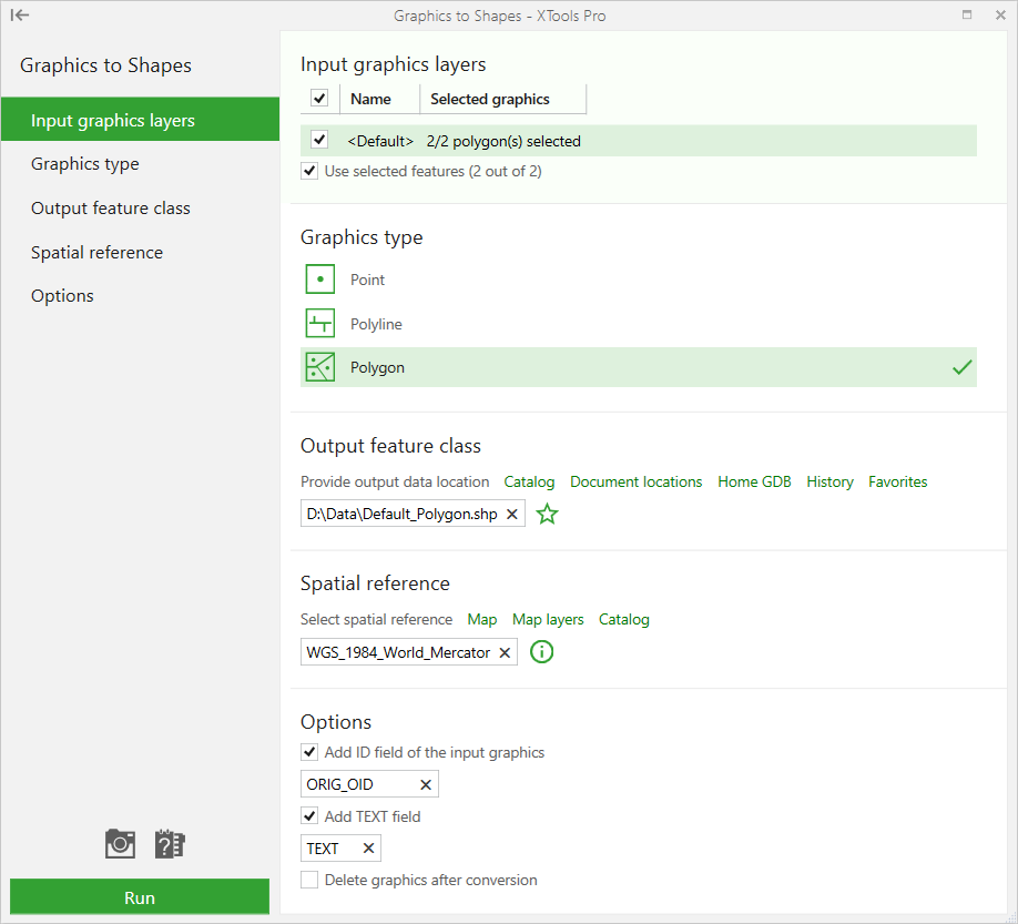
Select the "Graphics to Shapes" tool from the XTools Pro Feature Conversions menu.
-
Select input graphics layer to be converted to shapes.
-
Select graphics geometry type.
-
Specify the name and location of the output feature class.
-
Specify spatial reference.
-
Specify additional options:
adding ID field to store input features IDs
adding TEXT field to store text associated with the selected graphics (this is a useful feature to store different label and callout contents)
deleting input graphics after conversion
-
Press Run to convert selected graphics.