


Grid from Contours
#updated
Purpose
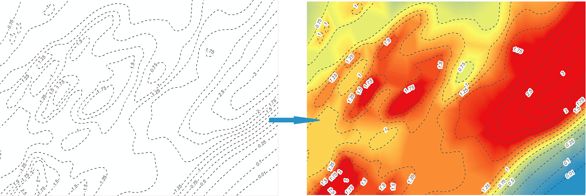
The tool is meant for creating grids from contour polylines. In other words, it converts contours into raster representation.
Description
Grid is a geographic representation of the world as an array of cells arranged in rows and columns. Each grid cell is referenced by its geographic X, Y location.
Contour and grid representations of geographic data are inter-convertible. This tool allows building grid of a certain cell size from contour layers.
Raster cell is a discretely uniform unit (square or rectangle) that represents a portion of the earth such as a square meter or square mile. Each pixel has a value that corresponds to the feature or characteristic at that site such as a soil type, census tract, or vegetation class.
Creating Grid from Contours includes two steps: triangulation and then interpolation. Prior to that grid parameters are to be defined.
Usage
-
Select the "Grid from Contours" tool from the XTools Pro Raster Tools.
-
Select the input layer containing contours, a polyline layer to be converted into a Grid.
-
Specify output Grid dataset. Following formats are supported for storing new Grids: Esri GRID, EDRAS IMAGINE and TIFF.
-
Select a numeric field with height source values.
-
Specify Grid cell size in units of an input layer.
Extent wight and height as well as the calculated Grid width and height are represented at the same section.
-
Specify a mask polygon layer if required. If a mask is selected then output Grid will be generated only within the mask area.
-
Press Run to create a new Grid.
Notes:
-
Output Grid isn't created if mask dataset doesn't cover any part of it.
-
Output Grid won't be clipped by the mask polygon features with incorrect geometry.
-
Output raster format, minimum default Grid size and mask buffer size can be customized (see XTools Pro Options).
-
The tool does not support 64-bit geoprocessing and always runs in foreground.