


Intersection Points
#updated
Purpose
|
Input features: |
|
|
Output features: |
|


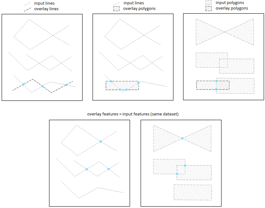
Intersection Points tool intersects two input datasets and outputs intersection points. Input feature classes can be polylines and polygons.
Description
The tool allows ArcGIS users to create intersection points intersecting two input datasets. Besides, if the same feature class is used as both the input and intersection datasets then self-intersection points will also be created.
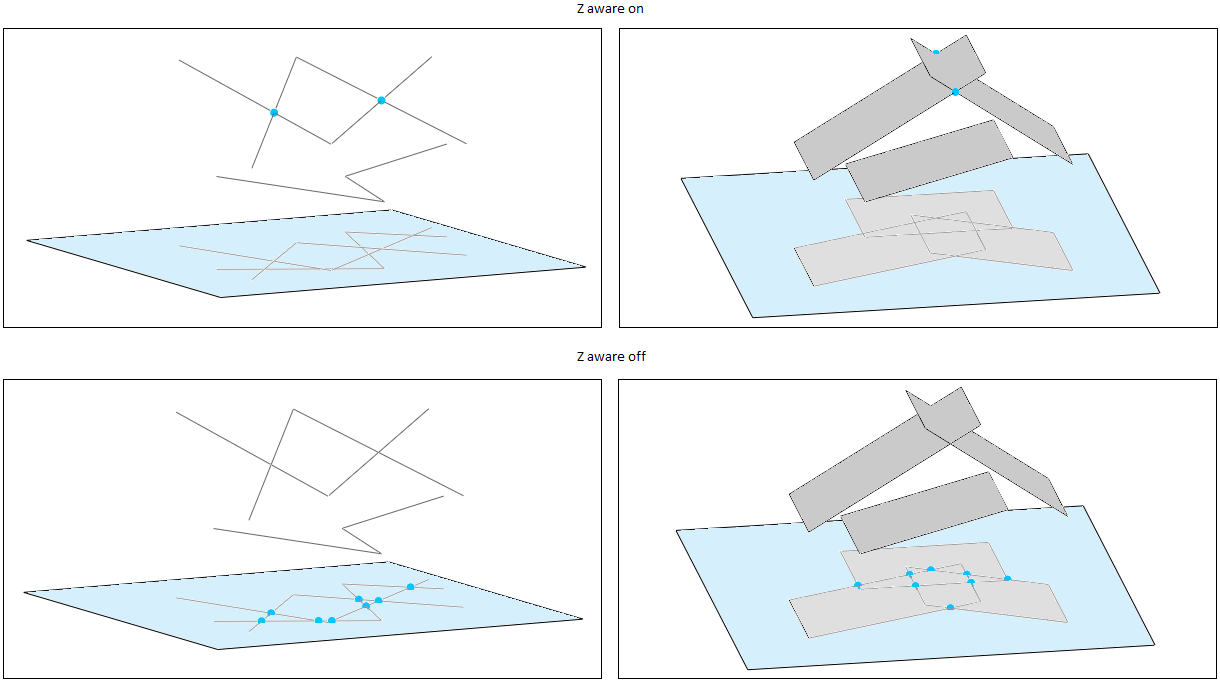
If the input datasets are both 3D, you can create intersection points taking into account Z coordinates with Z aware option (it can be selected in XTools Pro Options).
Usage
-
Select the "Intersection Points" item from the XTools Pro Analysis Tools.
-
Select the input dataset containing the features that you wish to intersect.
-
Specify the name and location of the output point feature class.
-
Select the intersection overlay feature class containing the features that will be intersected with the input features.
-
Select if you wish to remove duplicates in the output points layer. The option can be useful when intersecting polylines or polygons with the other adjacent polygons which may result in creating duplicate intersection points.
-
Press Run to perform the intersection operation.