Disperse Points
Purpose
Input feature types: 
Output feature types: 
This tool allows dispersing coincident or adjacent points more uniformly.
Description
The tool is provided for dispersing points with the distance between less than that specified within a given radius. The points distribution radius is measured from the points initial position or from the center of mass of the points cluster. Dispersed points are saved in a new feature class.
Disperse methods
There are two disperse methods available in the tool:
-
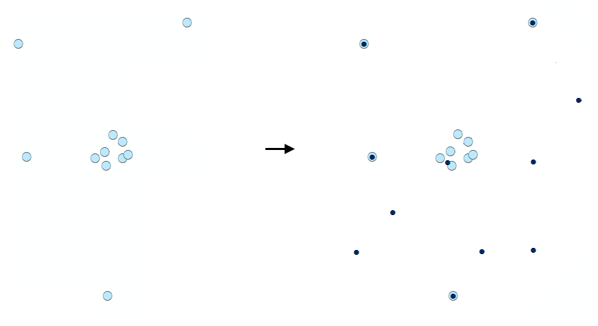
Randomly for each point
All points with the distance between less than that specified are randomly dispersed within a given radius.

The number of points in the output layer coincides with the input. Points with the distance between equal to or exceeds the tolerance will retain their position in the output layer.
-
By clusters using patterns:
Points with the distance between less than that specified are grouped into spatial clusters and the clusters are then dispersed within the given disperse radius. The cluster has a center of mass, which is calculated based on the location of each point in the group. The center of mass is used as a reference point to create a distribution on a given pattern.
Supported distribution patterns are:
-
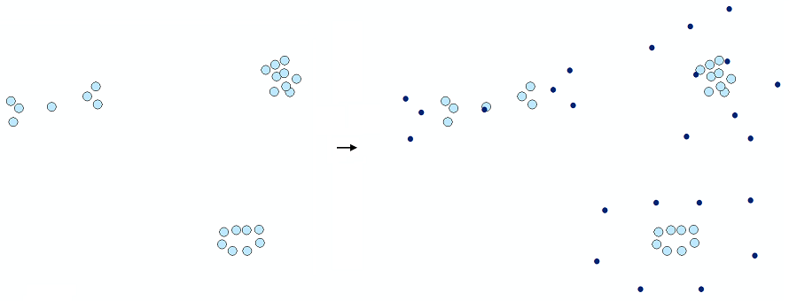
Expanded
General pattern of the input points will be kept as they are shifted. Exactly coincident points will form a circle around their center of mass.
-
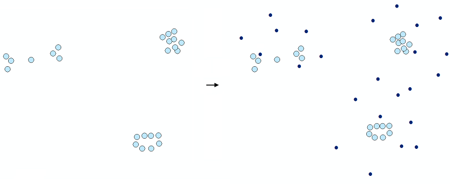
Random
Input points will be randomly moved around the center of mass in each cluster.
-
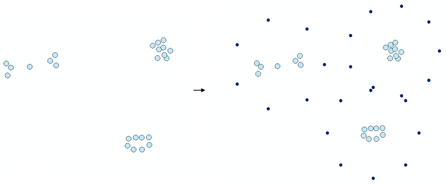
Ring
Input points will be placed uniformly along the circle around the center of mass in each cluster.
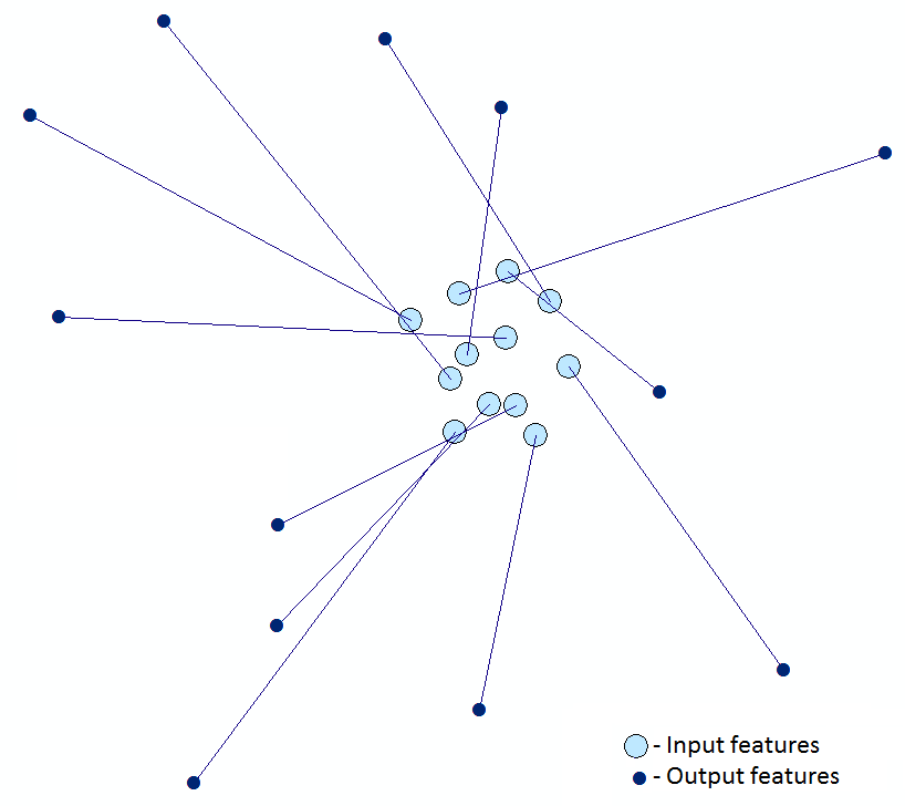
Leader lines
Besides, there are options to create leader lines connecting original and dispersed points and add original ID and XY coordinates to the attribute table.
Usage
-
Select the "Disperse Points" tool from the Geometry tools of XTools Pro menu.
-
Select the input layer with the points that you wish to disperse using Map Content, Catalog, History or Favorites.
-
Specify the name and location of the output feature class using Catalog, Default Path, Document locations, Home GDB, History or Favorites. The output data can be saved in a shapefile or in a geodatabase.
-
Specify the tolerance that determines the minimum distance between points and the radius within which the input points will be distributed. Distribution radius must be positive and exceed the tolerance.
-
Define the disperse method.
-
Select attributes to be added to the output feature class.
-
Specify output leader lines connecting original and disperse points if required.
-
Press Run to disperse points.
Note
Multipoint features cannot be used as input data.


