


Eliminate Slivers
Purpose
This tool allows to efficiently find and remove sliver polygons.
Description
Sliver polygons are usually small polygons resulting from such overlay operations as Intersect or Union. Sliver polygons normally have area a lot smaller than perimeter. The tool is provided for finding and eliminating such sliver polygons by merging them with neighboring polygons that have the largest area or the longest shared border. In contrast to the standard Eliminate functionality in ArcGIS the tool does not need the selected features. It finds and processes sliver polygons at once.
Usage
-
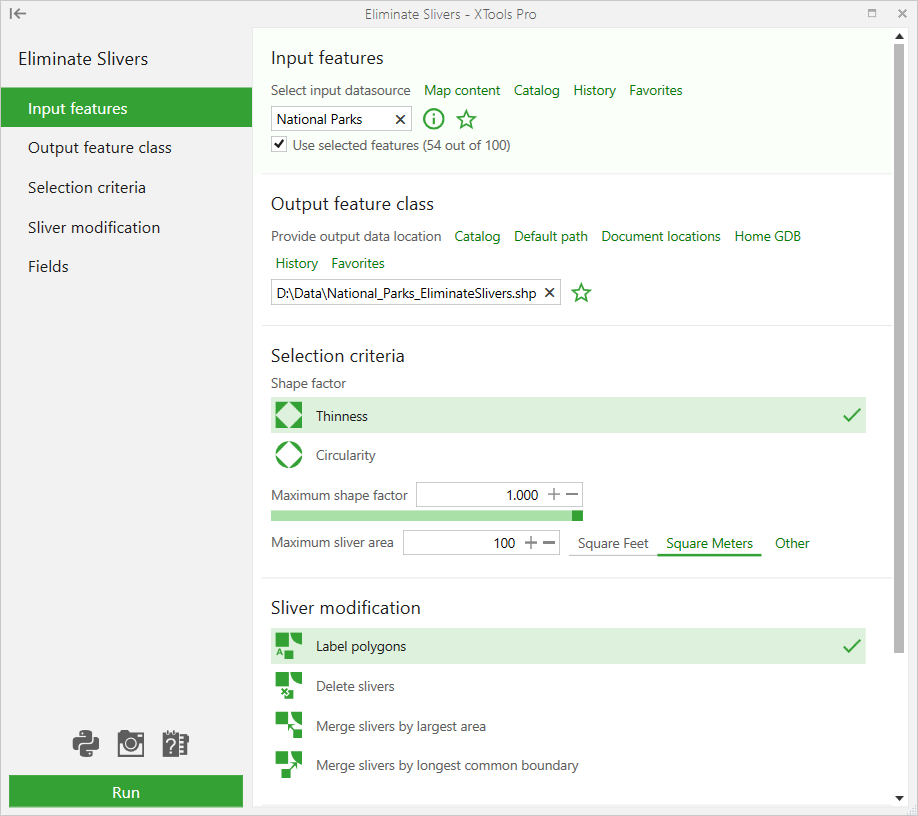
Select the "Eliminate Slivers" tool from the XTools Pro Feature Conversions menu.
-
Select the input layer potentially containing sliver polygons that you wish to eliminate.
-
Specify the name and location of the output feature class.
-
Define the slivers selection criteria.
-
Select modification for the found slivers.
-
Specify ID and Origin fields.
-
Press Run to eliminate slivers.
Selection criteria
Slivers can be selected by the following criteria:
-
Thinness
- This is a ratio of the polygon area versus its perimeter, thinner polygons are closer to 0. -
Circularity
- Circularity ratio shows how close the polygon is to a circle (it is 1 for circles).
-
Maximum shape factor
- Maximum shape factor value may vary from 0 to 1.
-
Maximum sliver area
- Polygons with smaller area will be considered as slivers.
Sliver modification
Found sliver polygons can be modified one of the following ways:
-
Label polygons
- Sliver polygons will be correspondingly labeled in the attribute table of the output feature class.
-
Delete slivers
- Sliver polygons will be remove from the output feature class.
-
Merge slivers by largest area
- Sliver polygons will be merged with a neighboring polygon with the largest area by dropping the shared border.
-
Merge slivers by longest common boundary
- Sliver polygons will be merged with a neighboring polygon with the longest shared border by dropping the shared border.
Origin field may have the following labels:
-
Intact - the input polygon has been copied to the output dataset “as is”.
-
Sliver - polygon considered as sliver (in case the modification “Label polygons” has been selected).
-
Merged - the output polygon has been merged with the nearest sliver.
-
Updated - the multipart polygon several parts of which considered as slivers.