


Import Data from KML
Purpose
KML, or Keyhole Markup Language, is an XML grammar and file format for modeling and storing geographic features such as points, lines, images, polygons, and models for display in Google Earth and Google Maps. You can use KML to share places and information with other users of Google Earth and Google Maps. Likewise, you can find KML files on the Google Earth Community site that describe interesting features and places.*
XTools Pro Import Data from KML tool allows importing data from KML/KMZ format to ArcGIS supported formats.
Description
Import Data from KML tool imports selected KML/KMZ files to shapefiles and geodatabase feature classes. Please note, that only vector features from KML/KMZ files are supported for importing in the current XTools Pro version. If there are no vector features stored in the input KML/KMZ file the corresponding message is prompted.
Importing KML files
-
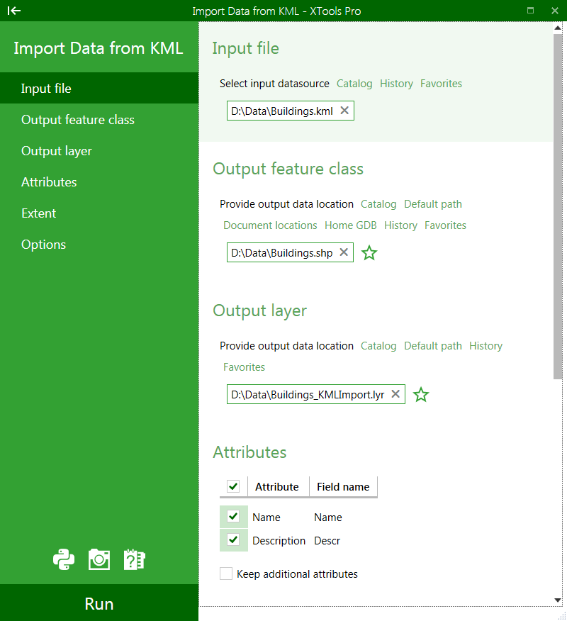
Select the "Import Data from KML" tool from the XTools Pro menu.
-
Select the input KML or KMZ file containing features that you wish to import.
-
Specify the name and location of the output feature class.
-
Specify the name and location of the output layer file.
-
Select the attributes you wish to import with the features.
-
Select if you wish to use any specific extent for importing and specify the extent.
-
Select if you wish to keep Z coordinate in the output dataset and import only visible placemarks (features).
-
Press Run to import features.
By default output dataset is placed in the same directory as input KML/KMZ file. Depending on the data geometry type(s) in the input KML/KMZ file there can be one or a few output shapefiles or feature classes. Accordingly, the words _points, _lines, or _polygons will be added at the end of the specified output dataset name. Likewise, the output layer file is placed in the same directory as out dataset, although you can manually select another directory.
Importing data from KML format you can select to keep attributes from the input KML file:
-
Name
-
Description
These are the default attributes but you can select to keep all additional attributes if there are any in the input KML file.
Additional optional attributes that can be added are:
-
Snippet
-
Address
-
TimeSpan: Begin
-
TimeSpan: End
-
TimeStamp: When
-
Extrude
-
AltitudeMode
-
Tessellate
+ plus any number of custom attributes that may be stored in the KML files
You can change default attribute field names for Name and Description, additional attributes will be imported as is.
Besides, there are following additional optional parameters available:
-
Keep Z coordinate
- this option allows importing 3D data
-
Import visible placemarks only
- using this option you can import only those features set as visible in the KML file .
* from the Google Earth User Guide.
--