


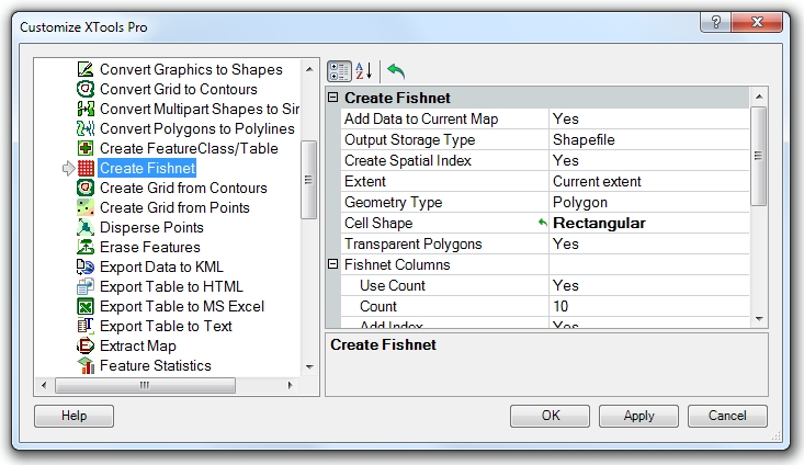
Customizing "Create Fishnet" tool
For the component "Create Fishnet" the following elements are customizable:
-
Add Data to Current Map: defines the default state of this option
-
Output Storage Type: defines the default output dataset type
-
Create Spatial Index: specifies if shapefile spatial index should be created
-
Extent: specifies what extent will be used
-
Geometry type: specifies output fishnet geometry type (polygon or polyline)
-
Cell Shape: specifies output fishnet cell shape, hexagonal or rectangular
-
Transparent polygons: specifies if output fishnet cells should be transparent (unfilled)
-
Fishnet Columns:
- Use Count: indicates if fishnet columns are defined by specifying number of columns
- Count: defines number of fishnet columns
- Add Index: specifies if columns index field should be added
- Index Style: specifies index style to be used (numbers or letters)
- Index Field Name: specifies columns index field name
- Invert Index: indicates if columns index should be inverted
-
Fishnet Rows:
- Use Count: indicates if fishnet rows are defined by specifying number of rows
- Count: defines number of fishnet rows
- Add Index: specifies if rows index field should be added
- Index Style: specifies index style to be used (numbers or letters)
- Index Field Name: specifies rows index field name
- Invert Index: indicates if rows index should be inverted
Having made any changes, please, click "Apply" or "OK" to save changes. Clicking "Cancel" will not save changes.
---