


Convert Features to Points
Purpose
This tool is aimed to the conversion of polygon and polyline features to points.
Description
The tool provides ArcGIS users with capabilities to convert polygon and polyline features to points with customizable options.
Usage
-
Select the "Convert Features to Points" tool from the XTools Pro Feature Conversions menu.
-
Select the input layer containing polylines or polygons that you wish to convert to points.
-
Specify the name and location of the output feature class.
-
Select input feature points to be converted.
-
Specify ID field to store input features IDs.
-
Press Run to convert features to points.
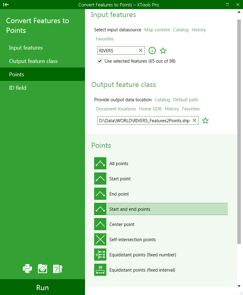
Following options are available for selecting input feature points:
-
All points
- all points (nodes) forming input features will be converted
-
Start point
- only the start points of the input features will be converted
-
End point
- only the end points of the input features will be converted
-
Start and end points
- both start and end points of the input features will be converted
-
Center point
- only the center points of the input features will be converted
-
Self-intersection points
- points of self-intersections in the input features will be converted
-
Equidistant points (fixed number)
- a given number of equidistant points will be derived from the input features and converted to points
(note that only values between 2 and 10 000 are allowed for this option)
-
Equidistant points (fixed interval)
- equidistant points with the fixed specified interval between them will be derived from the input features and converted to points:
(interval units can be selected)
---