


Note: this tool is redesigned in XTools Pro 12.0
Convert Multipart Shapes to Single Parts
Purpose
Multipart shapes can be found in polygon, polyline, and multipoint layers.
Description
Multipart polygons, for example, can be obtained after overlay operations that result in breaking an input polygon into two or more parts due to intersections with overlay layer polygons. Examples of multipart polygons can be found in the Esri sample data. The state of Alaska in the states.shp shapefile is one of them. Alaska has only one record in its table, but it has 32 parts including the mainland and 31 islands. Multipart polygons are not a problem for mapping and some spatial manipulations. They are not suitable, however, if you need to know something about a specific individual part of a multipart, like its size. For instance, as long as Alaska is a multipart feature, you would not be able to determine the size of any island, which is a part of Alaska.
This command converts selected multipart shapes to single part features and stores them in a new shapefile or geodatabase feature class. If no features are selected, all the layer features will be processed. Source shapes can be single part, multi-part or mixed in the layer. The output attribute table will contain the same fields as the input table.
Requires that there is at least one feature layer added in the map.
Usage
-
Select the "Convert Multipart Shapes to Single Parts" tool from the XTools Pro Feature Conversions menu.
-
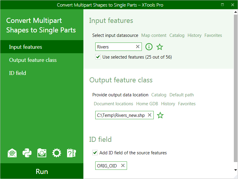
Select the input layer containing multipart features that you wish to convert to single parts.
-
Specify the name and location of the output feature class.
-
Specify ID field to store input features IDs.
-
Press Run to start conversion.
There are four options available in the tool:
-
Use selected features
- allows to process only selected features
-
Add output feature layer to current map
- allows to add output feature layer to current map
-
Create spatial index
- allows creating shapefile spatial index
-
Add ID field of the source feature
- allows to add ID field with source features IDs to the output attribute table. Default ID field name can be changed.
---