


Data Source Manager
Purpose
Do you often see red exclamation marks by the layer names in Contents pane of your maps? Lost and broken links to data sources in the maps can be a real problem, especially when you do not know exactly where the data is actually stored. The XTools Pro Data Source Manager tool addresses the problem of incorrect and lost links to data sources in maps resulting from moving, copying or sharing projects.
Description
With XTools Pro Data Source Manager tool you can easily fix invalid links to datasets in ArcGIS map documents. Incorrect links can be fixed manually and automatically. Another tool usage scenario is when you need to specially change data sources and re-direct layers to other data sources.
The next layer types are supported:
-
gdb, sde feature layers and layers from feature datasets (except topology, terrain, parcel fabric, network dataset)
-
gdb, sde raster layers, mosaic raster layers
-
gdb, sde tables
-
layers based on the shapefiles
-
dbf tables
-
ESRI Grids and different raster files
Changing data sources
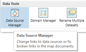
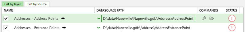
If you open a project and see that links to data sources are broken for some layers (i.e. they are grey and marked with red exclamation mark) you can try to fix broken links with the Data Source Manager tool. A corresponding message suggesting to fix broken links is automatically prompted right after you open a map document with lost data sources. To do that manually later select the tool from the XTools Pro Data Tools:
The tool dialog will appear listing all map layers. Broken or changed links are indicated in the list. In the example below the map document saved with full path names to data sources was moved to another directory on disk along with the data. As a result, links to data sources are invalid:
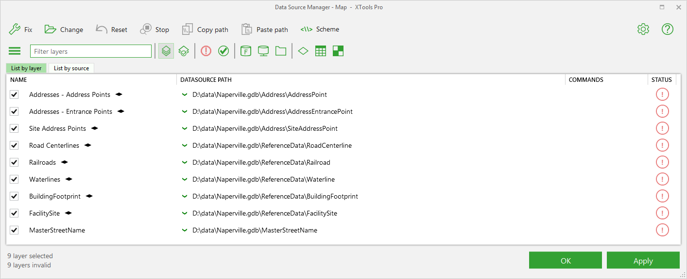
In the Data Source Manager dialog you have a few options, listed on the top and available for selected links:
-
Fixl
allows to automatically fix selected links. -
Change
allows to set the same new workspace (geodatabase or folder) for selected layers manually. -
Reset
resets changed selected links to the initial state. -
Stop
stops selected searches. -
Copy path
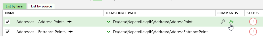
copies data source path from selected layer to clipboard (available only for one selected link). -
Paste path
allows to paste copied path from clipboard to selected layers. -
Schema
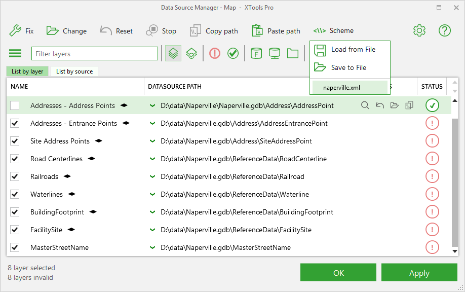
Load from file - allows to load links from the previously saved XML file.
Save to file - allows to save links to XML file on disk.
By default all links are selected.
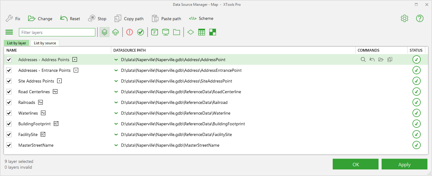
All invalid links in the map fixed (changed to valid ones):
Now you can press OK and see that layers appear on the map. If you have changed only part of links, you can apply them not closing the tool dialog (Apply button).
Note
Only valid links are applied to the
layers after pressing OK or
Apply buttons.
Changing data sources manually
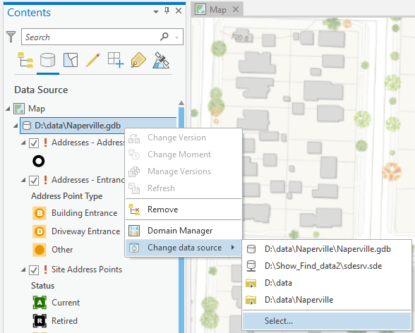
It is also possible to change data sources of each item manually, no matter if they are valid or not. You can use Change command to select required dataset in Catalog:
... or type the path in entry field:
Using Change data source command of the workspace context menu in the List by sources tab of Contents pane you can easily re-direct your map layers to another workspace.
You can select the needed workspace from the list of your project database and folder connections or from Catalog (Select command).
Searching for similar data sources
Besides changing data sources manually you can search for similar data sources automatically:
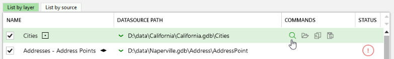
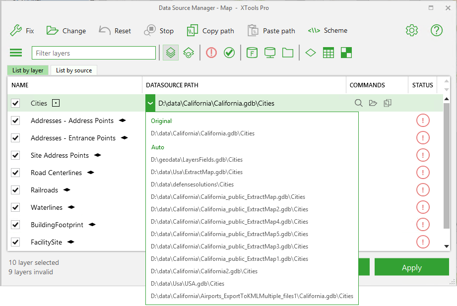
Searching for data sources are separate processes for each item. You can see how many candidates are found at the moment and you can also stop searching process for each item:
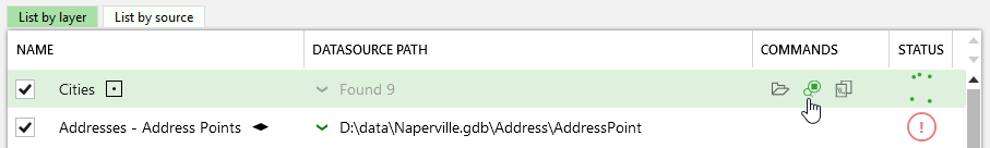
You can view search results in real time and after search finishing select the one you need:
Copying workspaces to other layers
Valid data sources (initially valid, fixed or changed manually) can be copied to clipboard
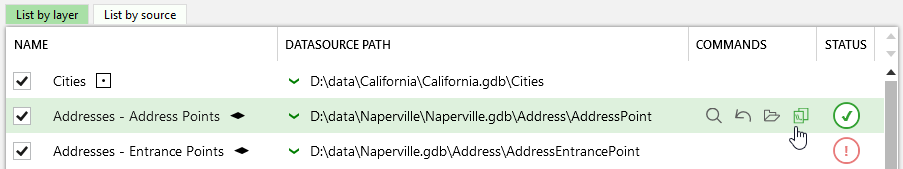
... and pasted to other layers in the map:

Besides, for often used cases and scenarios data sources can be saved and loaded as XML files. Recent loaded files are shown in the list and you can use them from the list without loading:
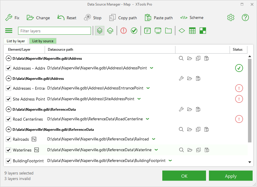
List by source tab
Map layers can be grouped by drawing order in Contents pane (List by layer tab) or by workspaces (List by source tab). You can fix the broken links automatically, change the valid data sources manually and others in the List by source tab as in the List by layer tab. At that, Fix, Change, Search, Stop, Copy path and Paste path buttons are also available for workspaces.
Fixing and searching algorithm
Here is how searching for data sources works:
-
Searching begins from the search start folder specified in the XTools Pro Options dialog, by default this is an APRX folder.
-
Searching moves up from the start folder to the drive root and down to the sub-folders with the search depth specified in the XTools Pro Options.
-
Then searching continues in the folders sibling with the start folder (If the option is selected in the XTools Pro Options) with the search depth.
-
After that, searching in the other options of Search start folder is produced in the same way.
-
Then it continues on all logical drives changing the drive letter in the original layer link only.
-
At that, data sources are searched in all project folder and database connections (If the option is selected in the XTools Pro Options) with the search depth.
Note:
Searching in the enterprise geodatabase is produced if the connection to
the database is added to the project and If the corresponding option is
selected in the XTools Pro Options.
Ranging search results
Automatic search results are ranked according to the following criteria (from high to low priority):
-
Dataset location
Datasets from the search start folder (as specified in the Options dialog) have higher rank.
-
Path length
The closer the dataset is to the drive root, the higher is its rank.
-
Proximity to the search start folder
Levenshtein distance is compared between found workspaces and the specified search start folder, workspaces with shorter distance have higher rank.
-
Workspace type (file or enterprise geodatabase, shapefiles or other data types)
Candidates with the same workspace as the original layer link have higher rank.