


Grid to Contours
Purpose
The tool is meant for converting raster data models (Grids) to contour polyline features (relief isolines, for example) with specified parameters.
Description
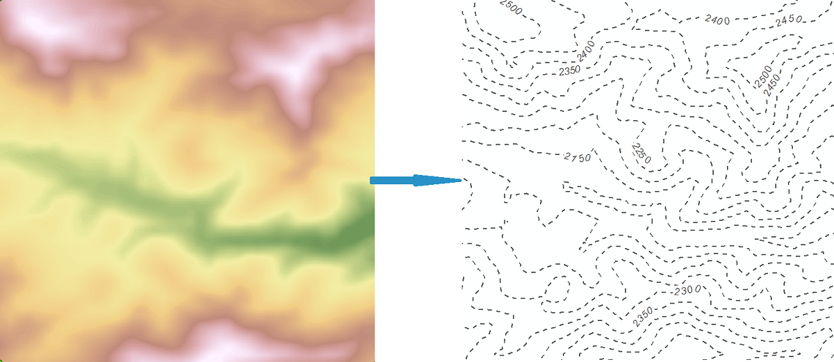
Contour is a line that typically connects points of equal elevation value on a terrain surface (an isoline). Grid is an opposite raster representation of geographic information. These two representations of geographic data are inter-convertible. Converting raster representation (Grid) is performed by defining contour parameters.
One Grid may have one or several bands. Band is a measure of a characteristic or quality of the features observed in a raster. Some rasters have a single band, others may have more than one. At that, only one band of a Grid can be converted to contours format in a single operation.
Usage
-
Select the "Grid to Contours" tool from the XTools Pro Raster Tools.
-
Select the input Grid/band to be converted to contours.
-
Specify the name and location of the output feature class.
-
Specify contour definition parameters: contour interval, base contour, Z factor.
-
Specify output Z field and select if you wish to drop bounding contours.
-
Press Run to convert selected Grid to contours.
Contour definition parameters
For contour definition the following parameters should be determined:
-
Contour interval
The contour interval parameter is an interval between each two neighboring polylines in a contour representation that will be built. Parameter must be positive value.
-
Base contour
The base contour parameter determines the minimum value of the contour representation. Parameter can be positive, zero, or negative.
-
Z factor
The Z factor parameter is a Z scaling multiplier, which, being not equal to 1, changes Z ranging of a contour representation. The base contour, being multiplied the Z factor, gives the minimum output contour value. Parameter must be positive. Contour interval is not multiplied by the Z factor.
Bounding contours
Bounding contours can be dropped if not required. Bounding contours depend on the raster cells with NoData value.