Import from GPX
#updated
Purpose
XTools Pro Import from GPX tool allows importing data from GPX file to ArcGIS (shapefiles or geodatabase feature classes) keeping the most part of attributes including extensions.
Description
GPX, or GPS Exchange Format, is a light-weight XML data format that stores recorded GPS data (waypoints, routes and tracks and their attributes) to use in different applications and online services. In GPX file all coordinates are in WGS84 coordinate system, all measurements are in metric units, timestamps are recorded in Coordinated Universal Time (UTC +00:00) conforming to ISO 8601.
Import from GPX tool imports GPX file data (version 1.0 and 1.1) to shapefiles and geodatabase feature classes (points and polylines). Attributes including extensions saved in GPX file will be kept in a feature class attribute tables. You can select output spatial reference to project GPX data into the coordinate system you wish. Also you may specify output time zone for converting input timestamps.
Notes:
-
Waypoints are converted to a Point Z feature class.
-
Routes are converted into two feature classes: Point Z feature class with route points and Polyline Z feature class with routes.
-
Tracks are converted into two feature classes: Point Z feature class with track points and Polyline Z feature class with tracks. Besides, each track polyline will be multipart feature where track segments will be parts.
-
If points from GPX file do not have elevation attributes, output feature Z coordinates will be "0".
Usage
-
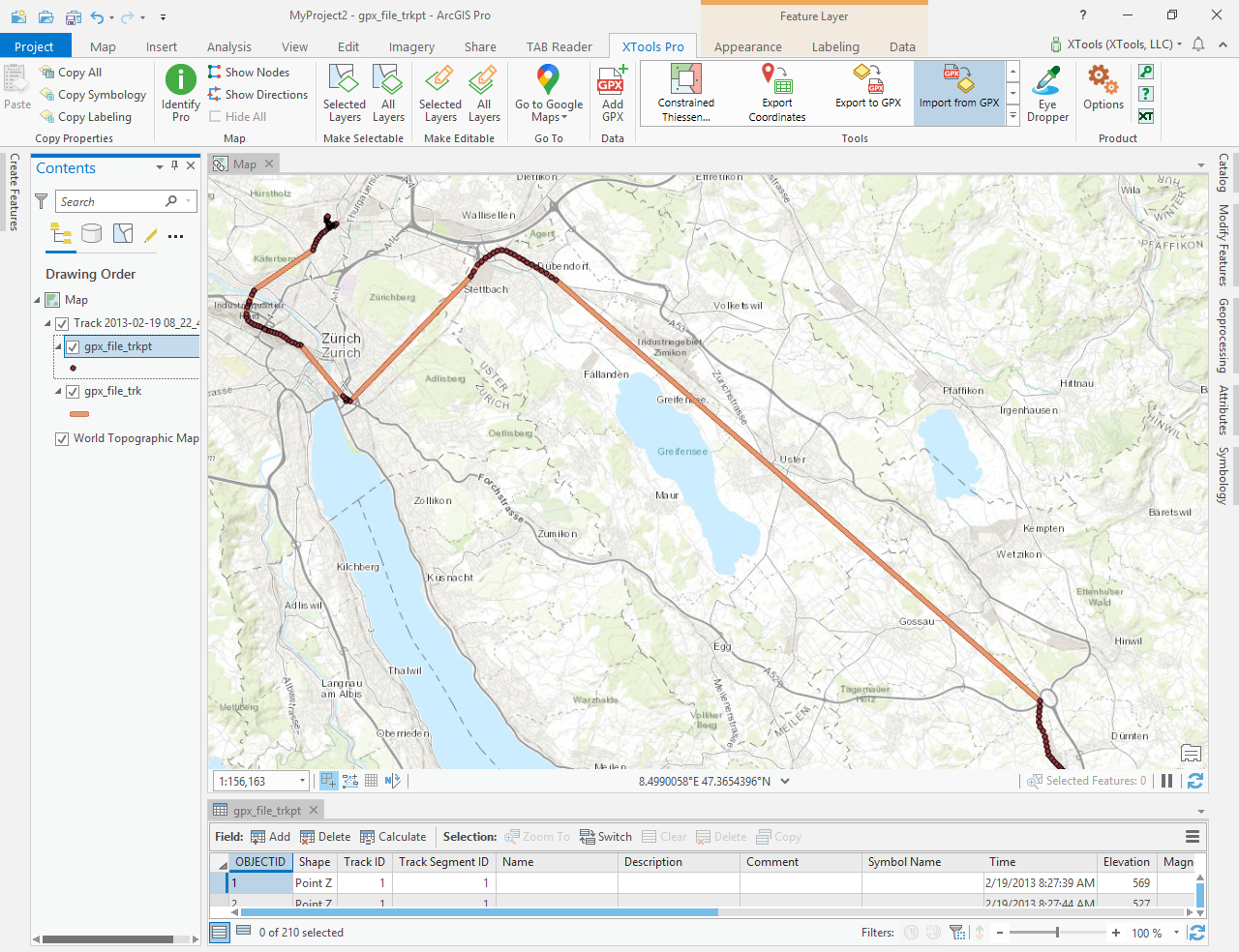
Select the "Import from GPX" tool from the XTools Pro ribbon.
-
Select the input GPX file containing features that you wish to import.
-
Select the output data storage location (a folder, a geodatabase or a feature dataset of a geodatabase).
-
Select the input GPX geometry type you wish to import and specify output feature class name to be saved in a specified storage.
-
Select the attributes you wish to import with the features and specify output attribute fields names if you wish.
-
Select if you wish to keep additional attributes including extensions recorded in the input GPX file.
-
Select the following options:
- output spatial reference
- output time zone
-
Press Run to import features.
By default output datasets are placed in the current project geodatabase.
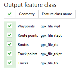
Specifying output feature class
Input GPX file can contain as one data type as several: waypoints, routes with route points and tracks with track points. You can select what input data type you wish to convert. By default the output feature class name consists of input GPX file name and one of the postfixes _wpt (for waypoints), _rtept (for route points), _rte (for route lines), _trkpt (for track points) or _trk (for track lines), but you can specify another output feature class name for each output geometry type if you wish.
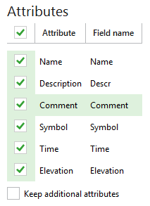
Importing attributes
All GPX version 1.0 - 1.1 attributes are supported. Importing data from GPX file you can select attributes that will be added to the output feature class attribute table from the input GPX file:
-
Name
-
Description
-
Comment
-
Symbol
-
Time
-
Elevation
Notes:
-
You can rename the output attribute fields but if you wish to export output feature class to GPX again in future, output attribute fields is not recommended to be renamed. It can allow you to export output feature class to GPX easily using XTools Pro Export to GPX tool.
-
Attributes, such as Symbol, Time and Elevation, are not available for route and track lines.
-
If input GPX features do not have selected attribute, output attribute field will be empty.
-
For route and track point feature classes additional service fields will be added: for route points - Route ID, for track points - Track Segment ID, Track ID.
-
Shapefile attribute field names cannot contain more than 10 symbols.
-
Text longer than 254 symbols from attributes will be cut when importing to shapefiles because of dBASE limitations.
You can select to keep all additional attributes that can be recorded in the input GPX file. Optional attributes that can be added are:
for waypoints, route points, track points:
-
magnetic variation (in degrees)
-
geoid height (in meters)
-
source
-
links
-
type (classification) of the point
-
type of GPX fix (none, 2d, 3d, dgps, pps)
-
number of satellites
-
horizontal dilution of precision (hdop)
-
vertical dilution of precision (vdop)
-
position dillution of precision (pdop)
-
number of seconds since last DGPS update (DGPS data age)
-
ID of DGPS station used in differential correction (1 ... 1023)
for routes and tracks lines:
-
source
-
links
-
GPS route/track number
-
type (classification) of the route/track
Besides, following extensions with their attributes are supported:
-
GARMIN GPX Extensions v2
-
GARMIN GPX Extensions v3
-
GARMIN Waypoint Extensions v1
-
GARMIN Trackpoint Extensions v1
-
GARMIN Trackpoint Extensions v2
Notes:
-
If original GPX file doesn't have some attribute data, these output fields will be empty.
-
Link attribute may be multiple. Count of output Link attribute fields is defined by the first geometry.
-
Extension attribute fields are defined by the first geometry.
-
Default additional attribute field names cannot be changed.
Selecting output spatial reference
If output spatial reference is not specified, GPX data will be imported in WGS84 coordinate system. You can specify another coordinate system for output feature classes. Output spatial reference can be selected from the current map, map layers or manually from Catalog.
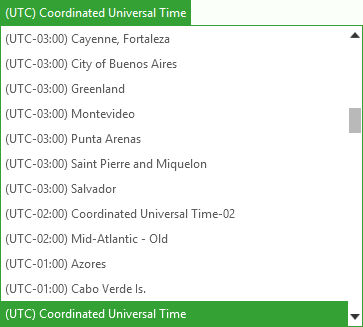
Selecting output time zone
By default all timestamps will be saved in output feature class attribute table in Coordinated Universal Time (UTC +00:00). You can convert them to another UTC time zone selecting it from the drop-down menu.