


Fill Holes
Purpose
Input features: 
Output features:
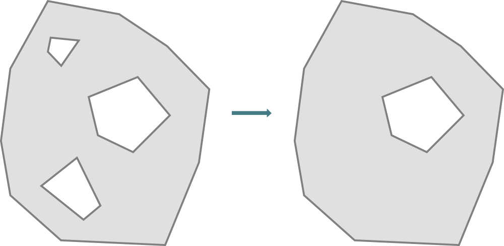
The tool provides filling the holes in the input polygon features.
Description
The tool removes holes with an area equal or smaller than the specified value in the input polygons. All input attribute fields will be transferred to the output feature class.
Usage
-
Select the "Fill Holes" tool from the Analysis tools of XTools Pro menu.
-
Select the input layer containing holes to be filled.
-
Specify the name and location of the output feature class.
-
Specify the coordinate system to calculate the hole area if required.
-
Specify Maximum hole area value, holes with smaller area will be filled (available for projected coordinate system specified only).
-
Specify ID field to store input features IDs.
-
Press Run to fill holes.
Notes
-
By default the input spatial reference will be used. When specifying another spatial reference, input dataset won't be re-projected, the coordinate system and units are used only for calculating hole area values.
-
If the geographic coordinate system is specified, the Maximum hole area parameter will be disabled and all the holes will be filled after the tool running.
-
Maximum hole area parameter can be only positive or empty (by default). If the parameter is empty, all holes will be filled in the input polygon features.
-
Features with incorrect or null geometry won't be kept in the output feature class.
-
For multipart polygon with the parts nested in its hole, the hole area value is calculated as a substraction of the interior ring area and all exterior rings areas of the nested parts.