Features to Points
Purpose
|
Input features: |
|
|
Output features: |
|


The tool converts polygon and polyline features to points. Location and number of output points is managed with the tool parameters.
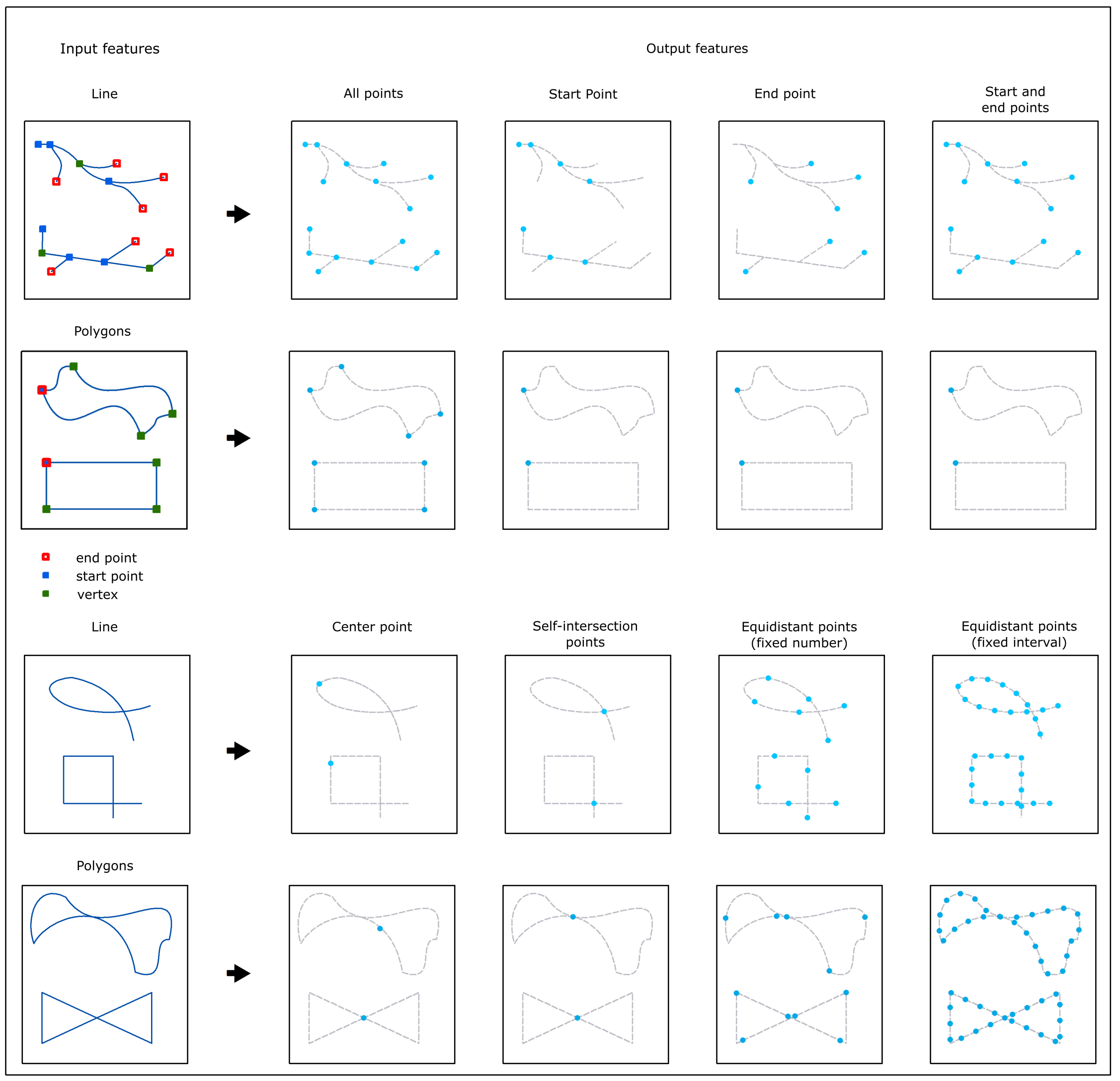
Using various combinations of input features and parameters the following results may be obtained:
Description
The tool creates a new point feature class from the input polygon and polyline features.
Attributes of the input features are transferred to the output point feature class. As an option, input feature IDs can be added as well.
Multipart features are considered as a single polygon or polyline. Therefore, each multipart feature will have only one Start, End and Center point.
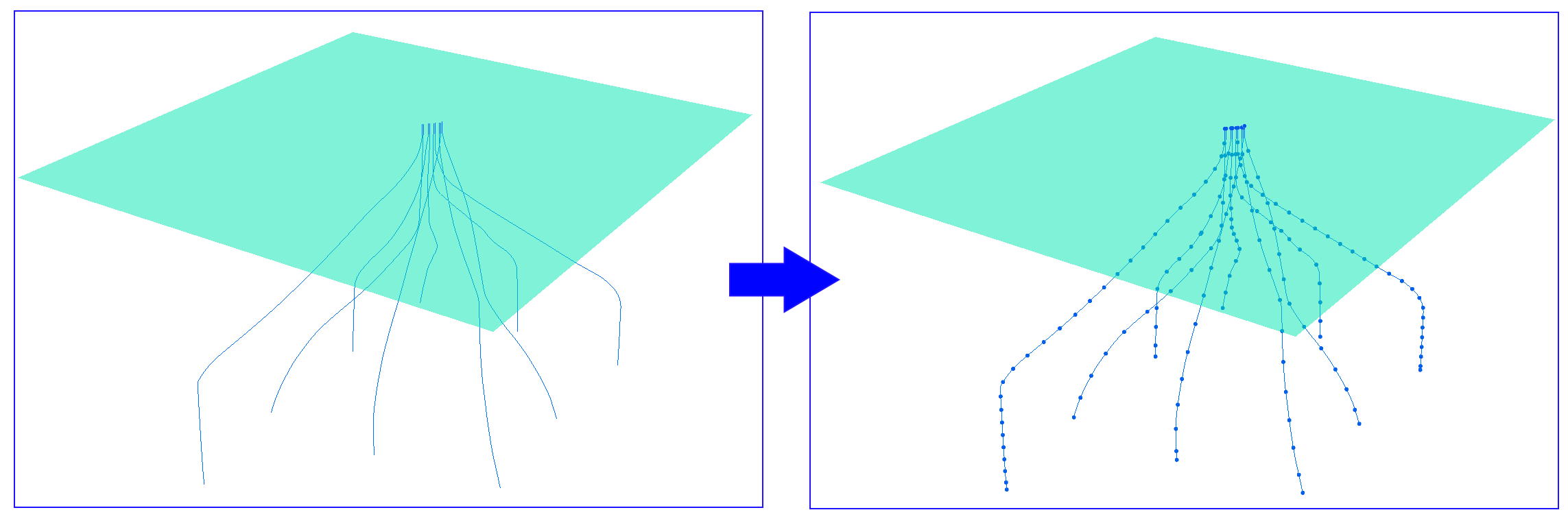
For 3D features points are created considering the Z coordinate.
Usage
Output points depend on the following parameters:
-
Input features
Input features can be polylines and polygons. If there are any selected features, there is an option to process only selected features.
-
Output feature class
This parameter specifies output point feature class.
-
Points
Following options are available to specify output points:
-
All points
all points (nodes) forming input features will be converted
-
Start point
only the start points of the input features will be converted
-
End point
only the end points of the input features will be converted
-
Start and end points
both start and end points of the input features will be converted
-
Center point
only the center points of the input features will be converted
-
Self-intersection points
points of self-intersections in the input features will be converted
-
Equidistant points (fixed number)
a given number of equidistant points will be derived from the input features and converted to points (note that only values between 2 and 10 000 are allowed for this option)
-
Equidistant points (fixed interval)
equidistant points with the fixed specified interval between them will be derived from the input features and converted to points. At that, interval units and direction of points generation (Start to End or End to Start) can be selected.
-
ID Field
This allows adding input feature IDs to the attribute table of output points. Default ID field name can be changed.
Usage example
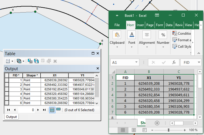
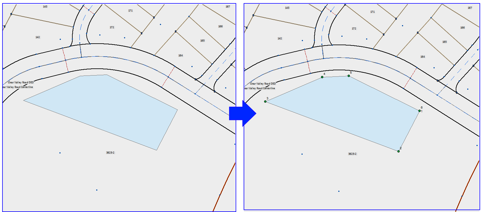
Deriving coordinates of angle points of land lots:
1. Convert lot polygons to points using the Features to Points tool:
2. Add coordinates to points using the Add X,Y,Z Coordinates tool:
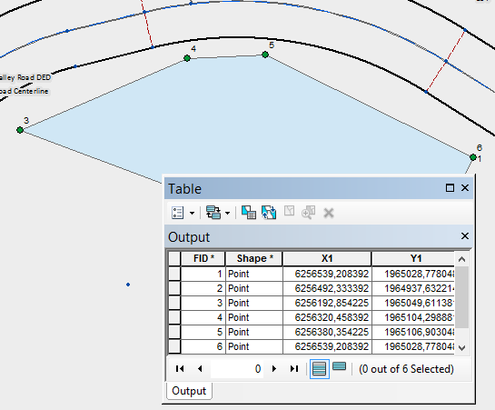
3. Export point coordinates and other required attributes to Excel, text or HTML files using the Table to File tool: